Published: 12:00 AM, 29 December 2018
Sangu River : Natural beauty of Bandarban

The Sangu River is a river in Myanmar and Bangladesh. Its source is in the North Arakan Hills of Myanmar, located at 21°13´N 92°37´E. The Arakan Hills form the boundary between Arakan and the Chittagong Hill Tracts. It follows a northerly circuitous course in the hill tracts and then enters Bangladesh near Remarki, Thanchi Upazila, Bandarban District, from the east.
It flows north through Thanchi, Rowangchhari and Bandarban Sadar Upazilas of Bandarban District. It then flows west through Satkania and Banshkhali Upazilas in Chittagong District and flows into the Bay of Bengal near Chittagong, at 22°6´N 91°51´E, or about 16.09 kilometres (10.00 mi) south of the mouth of the Karnafuli River. The length of the river is 270 kilometres (170 mi); 173 kilometres (107 mi) are located within Bangladesh.
Sangu River is the complete part of the natural beauty of Bandarban. It follows a northerly circuitous course in the hill tracts up to Bandarban. It enters the district from the east and flows west across the district and finally falls into the Bay of Bengal at the end of a course of 270 km.

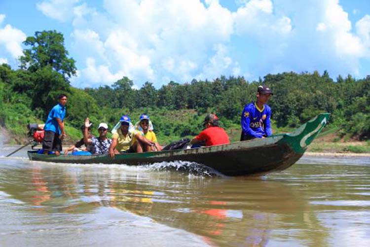
This river is flowing through the hills thousands of years. It is an important route to communicate with Ruma and Thanchi Upazila. It has huge financial interests for the population of Bandarban. This river is widely used for transportation, agricultural and other necessary products for the people of remote community.
In the winter season the current of the river almost becomes stagnant but in the rainy season the current becomes aggressive. Visitor must be attract with the beautification scattered on the both sides of it. You can find here hills, forests, falls with a river together. All the way you will be thrilled only and it is simply amazing.
The major tributaries of the river are the Chand Khali Nadi and Dolukhal. The Chand Khali Nadi flows through the Patiya Plains, and the Dolukhal River drains into the Satkania Plains. Another tributary is the Kumira Khali, which drains into the Kutubdia Channel. There are seven Bangladesh Water Management Board hydrometric stations on this river, which have been recording data since 1965.
The Sangu drains off the waters of Patiya, Satkania, and Banshkhali Upazilas. It has a connection with the Karnafuli River through the Chand Khali River. The Sangu is a shallow river, but it becomes violent during rains and develops rapid currents. It is navigable up to 48.27 kilometres (29.99 mi) from the estuary. The Sangu gas field is located about 50 kilometres (31 mi) southwest of Chittagong and reaches a depth of 10 meters at its mouth.
How to go
How to go
From Bandarban, take local transport such as jeep to reach Remakri Union to watch that beautiful river of Bandarban.
How to reach: Bandarban District
How to reach: Bandarban District
Dhaka and Bandarban are linked by road. There are direct bus services available from Dhaka to reach Bandarban.
Travel tips
Travel tips
You will enjoy a magnificent river cruise in Sangu and there are so many spots to arrange a picnic. You can hire traditional boats or engine boats from the old Sangu Bridge or from Boat-ghat at Kyachingghata.